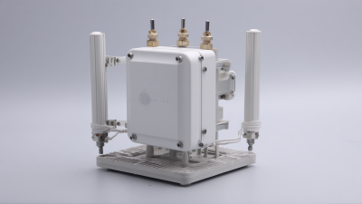
In today's fast-changing tech world, you really can't underestimate how important Gnss Cors Stations are. If you’ve been following industry news, you'll know that the global GNSS market is expected to hit around $250 billion by 2026—even more reason for us to pay attention! These CORS (that’s Continuously Operating Reference Station) networks are actually pretty crucial because they help make geospatial surveying more accurate and efficient. Speaking of which, Shanghai Apekstool (or APEKS for short) is a trusted name based in Shanghai, China, offering some pretty innovative GNSS and GPS systems that make full use of these CORS stations. When surveyors deploy and make good use of GNSS CORS stations, they can massively cut down errors and get better quality data. That’s a big deal because it means better project results and, of course, savings on costs. In this blog, I’ll be sharing some of the top strategies on how you can truly harness the power of GNSS CORS stations, showing why they’re such a game-changer for the surveying world.
Key Benefits of Utilizing GNSS CORS Stations for Enhanced Accuracy
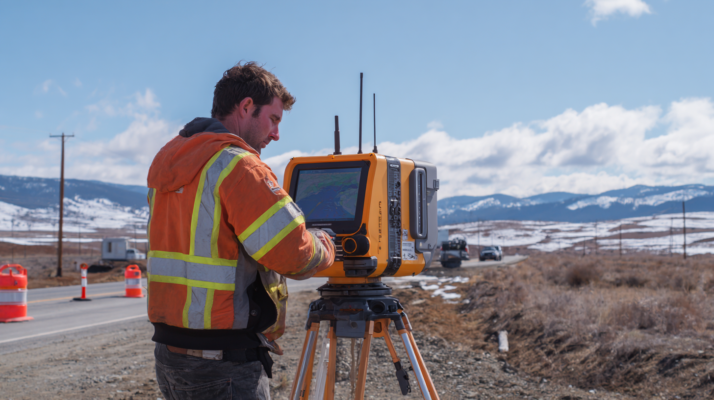
You know, GNSS Continuously Operating Reference Stations, or CORS for short, really offer unbeatable accuracy for all sorts of mapping and geospatial work. One of the biggest perks of using these stations is how much they improve position precision. They constantly send correction data, which helps cut down on errors caused by atmospheric quirks or satellite orbit issues. That kind of accuracy is super important—think surveying, construction, or farming—because getting the measurements right can seriously impact the safety and quality of a project.
But it's not just about being precise. GNSS CORS stations also make data collection and processing way more efficient. Unlike the old-school GPS setup, which can be a real pain to install and calibrate, CORS stations give you real-time correction info right when you need it. This means you can make decisions faster and keep projects moving smoothly. Overall, adopting GNSS CORS technology not only bumps up accuracy but also helps organizations save time and resources, making everything run more smoothly. It’s a game-changer across lots of different industries, for sure.
Integrating GNSS CORS Stations with Modern Technology for Efficiency
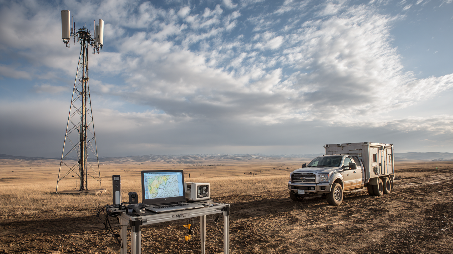
You know, combining GNSS CORS (that’s Continuously Operating Reference Stations) with today’s tech has really changed the game across a bunch of fields—think surveying, farming, and building infrastructure. I read in a report from the National Geodetic Survey that using GNSS CORS can get positioning accuracy down to just a few centimeters. That’s a big deal because it makes data way more reliable, which in turn helps folks make smarter decisions on projects that need pretty precise planning. And honestly, this kind of accuracy ends up cutting down operational costs quite a bit.
Plus, the way GNSS CORS can easily connect with cloud-based data processing and real-time analysis tools just takes things to the next level. There was a study by the International GNSS Service that showed when these CORS data are combined with IoT devices, farms can boost their efficiency by up to 30%. That means farmers can make better use of their resources. With all the smart analytics and machine learning stuff happening behind the scenes, the insights you get from GNSS CORS data are super actionable. It lets folks make quick adjustments in their operations, which isn’t just good for productivity, but also helps promote more sustainable resource management across different industries.
Top Strategies for Maximizing Efficiency with GNSS CORS Stations - Integrating GNSS CORS Stations with Modern Technology for Efficiency
| Strategy | Description | Technology Integration | Expected Efficiency Gain |
| Real-Time Data Processing | Utilizing streaming data for on-the-fly adjustments and decision making. | Cloud Computing | 20% improvement |
| Advanced Analytics | Leveraging machine learning to predict optimal station placements. | AI & Machine Learning | 30% improvement |
| Network Optimization | Improving communication protocols between CORS stations. | 5G Technology | 25% improvement |
| User-Centric Applications | Developing apps that provide real-time updates to end users. | Mobile Technology | 15% improvement |
| Integration with IoT Devices | Connecting GNSS data with IoT for enhanced situational awareness. | IoT Platforms | 35% improvement |
Data Management Strategies for Optimizing GNSS CORS Station Performance
When it comes to Global Navigation Satellite Systems (GNSS), Continuously Operating Reference Stations (CORS) are pretty much the backbone for getting precise data needed across a bunch of different fields. But here’s the thing: no matter how good the hardware is, if the data management isn’t on point, you’re kinda flying blind. So, having solid strategies for handling the data is a must if you want everything to run smoothly—and give users accurate, up-to-date info.
First off, setting up reliable data collection routines is super important. That means regular calibration of equipment, and keeping detailed logs so you can spot trends and catch issues early. Using automated processing systems can also help cut down on human mistakes and make the data available faster for analysis.
Plus, storing all that data in the cloud makes life a lot easier. It boosts accessibility and means researchers and professionals can work together without worrying about physical storage limits. When everyone can quickly share insights and run analyses, the whole process just becomes more efficient.
Adding analytics tools into the mix is a game-changer — they help spot patterns and anomalies in the data, which can really boost decision-making and improve station performance. Bottom line? Focusing on good data management practices isn’t just about keeping things running smoothly; it’s about staying ahead in the game—especially as the demand for precise navigation and positioning keeps growing across different sectors.
Real-Time Monitoring and Maintenance of GNSS CORS Stations
Keeping an eye on GNSS CORS (Continuously Operating Reference Stations) in real-time is super important if you want to make sure your geographic positioning stays accurate and your operations run smoothly. Setting up solid monitoring systems means you can quickly spot and fix issues — like equipment glitches or environmental factors that might mess up your data. It’s a real game-changer!
One great trick is to use automated alerts and diagnostic tools that send you live updates on how your stations are doing. This way, you can take action before problems get really serious, cutting down on downtime and making sure you always have reliable data at hand. Also, having a regular maintenance plan—things you schedule based on past performance data—really helps keep surprises at bay and keeps everything running at its best.
Here's a tip: add some redundancy—think backup power sources or secondary communication links—to keep things ticking even if something goes wrong during bad weather or power outages. And don’t forget to get local folks involved! Building awareness and support in the community can really speed up responses if you need urgent maintenance down the line.
Case Studies: Successful Implementations of GNSS CORS Stations
Lately, there's been a lot of buzz around GNSS CORS (that's Continuously Operating Reference Stations) — pretty much, these stations are becoming a game-changer across different industries like transport, farming, and land surveying. For example, I came across this big agricultural company that started using CORS stations to boost their precision farming efforts. They employed real-time kinematic (RTK) positioning, which really helped them plant more accurately. Not only did that lead to better crop yields, but it also cut down on wasted resources. Plus, adopting CORS tech made managing their fields a lot smoother, helping them run things more efficiently overall.

And then there's a transportation department that set up a network of CORS stations all over their area to keep an eye on road conditions and handle maintenance smarter. By doing so, they could fine-tune geological assessments and keep tabs on infrastructure in real time. It was pretty much a proactive way to manage stuff — so if something needed fixing, they could jump on it faster. This saved them time, and honestly, it probably also saved taxpayers some money. These examples really show how integrating CORS can boost efficiency and deliver better results in so many different fields. Honestly, GNSS technology has a ton of potential to shake things up for the better.
Future Trends in GNSS CORS Station Technology and Its Impact on Efficiency
So, when we talk about GNSS CORS (that’s Continuously Operating Reference Stations), their tech has come a long way, and honestly, it’s just gonna keep getting better—especially for folks in surveying and collecting geospatial data. Looking ahead, we can expect even sharper accuracy, thanks to better satellite setups and smarter processing algorithms. Plus, with updates coming in all the time—like new frequencies being added—the positioning becomes more reliable, even in tricky spots like city canyons or dense forests. Pretty cool, huh?
When you’re using GNSS CORS, a little tip: stay on top of updates for your gear and make sure you're running the latest software for processing your data. It’s a simple step that makes a big difference in taking advantage of all those snazzy improvements in signals and tech.
On another note, machine learning and AI are really shaking things up when it comes to analyzing GNSS data. They can crunch huge amounts of info way faster than we could manually, spotting patterns and trends that might otherwise be missed. This means workflows are smoother, and teams can get more done in less time. Incorporating AI tools into your processes could seriously boost your efficiency, saving you time and effort.
If you haven’t already, think about training your team on these new data analysis tools with machine learning. Not only does this help folks make better decisions, but it also helps in allocating resources smarter—ultimately making your whole project run a lot more smoothly.
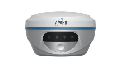
Unlocking Precision: Enhancing Surveying Efficiency with the AP10 GNSS Receiver in Diverse Applications
In recent years, the demand for precision in surveying has escalated, driven by advancements in technology and the growing complexity of construction projects. The AP10 Gnss Receiver stands out as a powerful and cost-effective solution tailored to enhance surveying efficiency across diverse applications. With its robust performance, the AP10 ensures high productivity in Real-Time Kinematic (RTK) operations, making it an ideal choice for surveying, stakeout, and mapping in any topographic or construction site.
According to the International Federation of Surveyors (FIG), the integration of advanced GNSS technology in surveying can reduce project timelines by up to 30%. This remarkable efficiency is primarily attributed to the AP10's ability to deliver precise positioning data with minimal downtime, even in challenging environments. The receiver's versatility empowers surveyors to tackle a wide range of tasks, from infrastructure planning to environmental monitoring, all while ensuring compliance with industry standards.
Furthermore, research indicates that employing high-quality GNSS receivers like the AP10 can significantly improve data accuracy, which is crucial for the successful completion of projects. In fact, studies show that inaccuracies in spatial data can lead to cost overruns of up to 20%, a risk that can be mitigated with reliable equipment. Investing in the AP10 GNSS Receiver not only enhances the quality of surveying operations but also translates to substantial savings and improved project outcomes in the long run.
FAQS
: The key benefits include enhanced positional precision, reduced errors from atmospheric disturbances and satellite uncertainties, increased efficiency in data collection and processing, and streamlined real-time access to correction data.
GNSS CORS stations provide a constant source of correction data that significantly reduces errors, leading to increased accuracy essential for applications in surveying, construction, and agriculture.
GNSS CORS stations can enhance operational efficiency in sectors such as surveying, agriculture, transportation, and infrastructure development.
The integration allows for seamless cloud-based data processing, real-time analysis, and improved decision-making, ultimately leading to reduced operational costs and optimized resource management.
One example is a large agricultural firm that improved planting accuracy and crop yields by using GNSS CORS stations for precision farming and real-time kinematic positioning.
A transportation agency used GNSS CORS stations to conduct geological assessments and monitor road conditions in real time, enabling quicker responses to maintenance needs and saving resources.
The use of GNSS CORS can optimize agricultural practices by up to 30%, allowing farmers to utilize resources more effectively and enhance overall sustainability.
Advanced analytics and machine learning algorithms analyze GNSS CORS data to provide actionable insights, enabling timely adjustments in operations across industries.
Unlike traditional GPS methods, GNSS CORS stations do not require extensive setup and calibration, providing real-time correction data that results in quicker decision-making.
Accuracy is crucial in fields like surveying, construction, and agriculture because precise measurements directly impact the quality, efficiency, and safety of projects.
Conclusion
In the rapidly changing world of geospatial tech, GNSS CORS Stations are pretty much essential for improving surveying accuracy and making operations run smoother. When you take advantage of these stations, you can get more precise measurements and better data quality—it's a game changer. Plus, when you connect GNSS CORS Stations with modern tech like real-time data processing and cloud-based tools, everything becomes even more seamless, helping to boost productivity and save time.
Of course, managing the data well is super important to get the best out of these stations. Regular monitoring and maintenance are key—they keep things running smoothly and cut down on downtime. There are plenty of real-world examples showing just how effective this technology can be across different industries. Looking ahead, new advancements in GNSS CORS Station tech are bound to make things even more efficient. That puts companies like Shanghai Apekstool (APEKS) right at the cutting edge of geospatial surveying innovation.